Jack Reports 2022
a unidirectional navigator for the truck driver community
Introduction
For decades, innovators have devised creative ways to track movement on a map. In the 1920s, drivers wore wrist maps, where a small map replaced the watch dial. In 1909, a scrolled map attached to the steering wheel was advertised. The Italian Touring Club went further in the 1930s, tethering the map scroll to a speedometer, creating the first device to show real-time position.
Inspired by the evolution of navigation devices, we reimagined how truck drivers navigate today.

Examples of early automobile navigation devices: Plus Fours Routfinder wrist map, Baldwin Auto Guide, and Iter-Auto.
Target audience
Jack Reports is an app designed specifically for US truck drivers. Through user interviews, we explored the needs, preferences, and unique constraints that truckers face. They can’t park or turn wherever they want, and their primary focus is getting to their destination with minimal distraction. The funny thing is, unlike ordinary drivers, truckers don’t care what’s happening to the left of the road – because they can’t get there fast enough anyway.
Problem
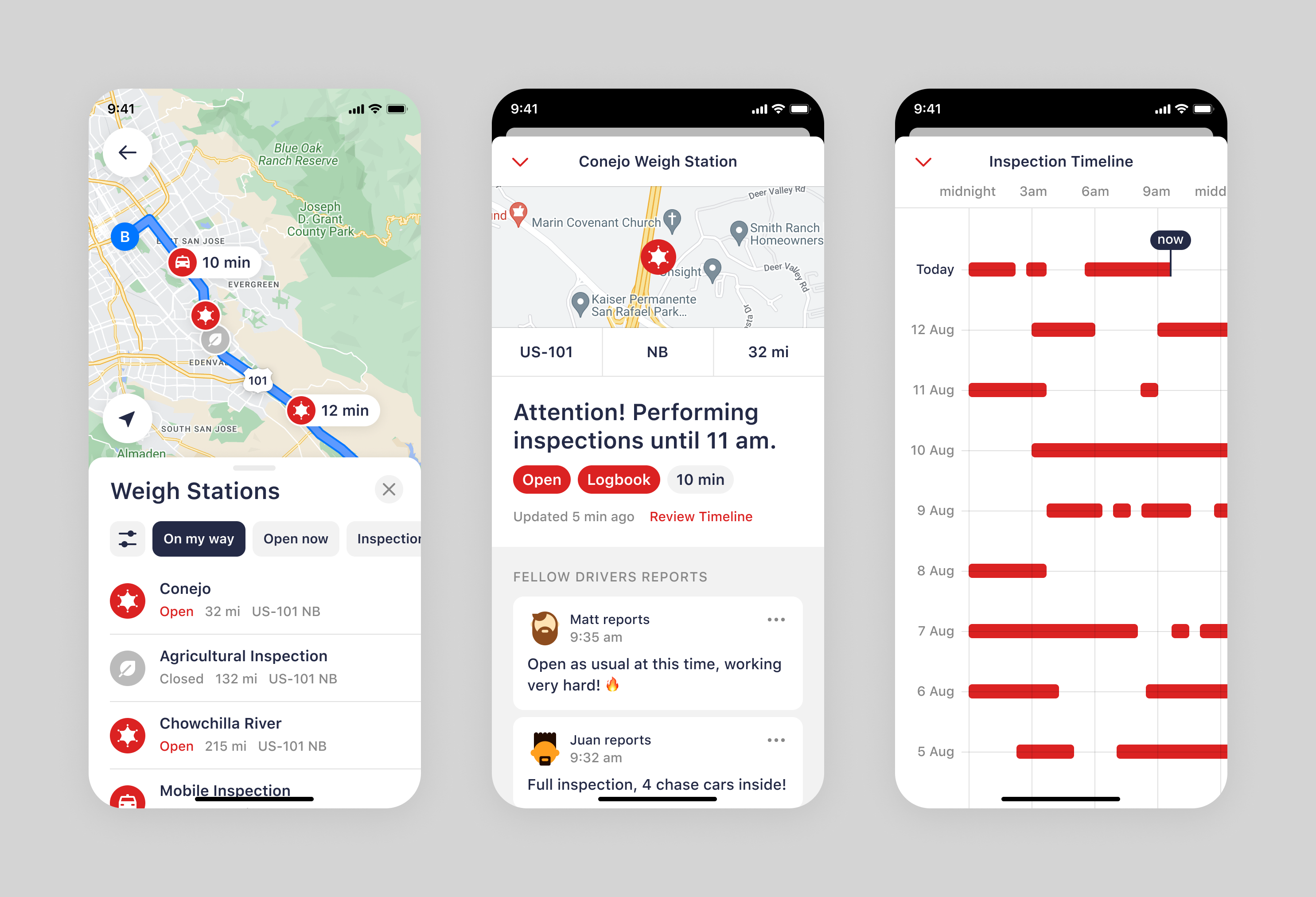
Jack Reports initially launched as an AI-driven, community-supported database of truck-specific places. Drivers used it for trip planning but switched to conventional navigation apps while driving. This led to frequent distractions when checking place status updates.
From a business perspective, this limited the time drivers spent in the app, reducing opportunities for engagement, community contributions, and potential monetisation.
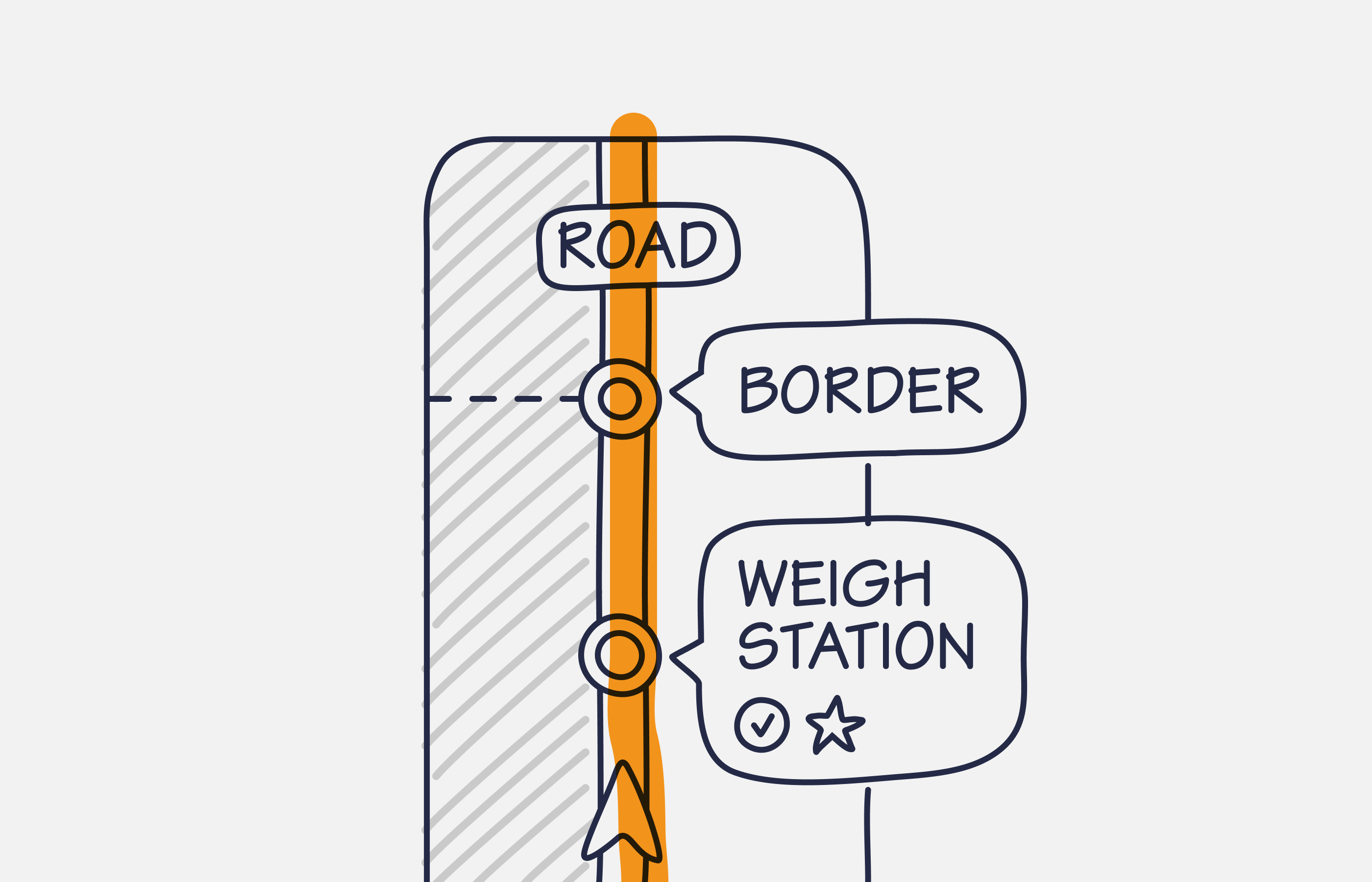
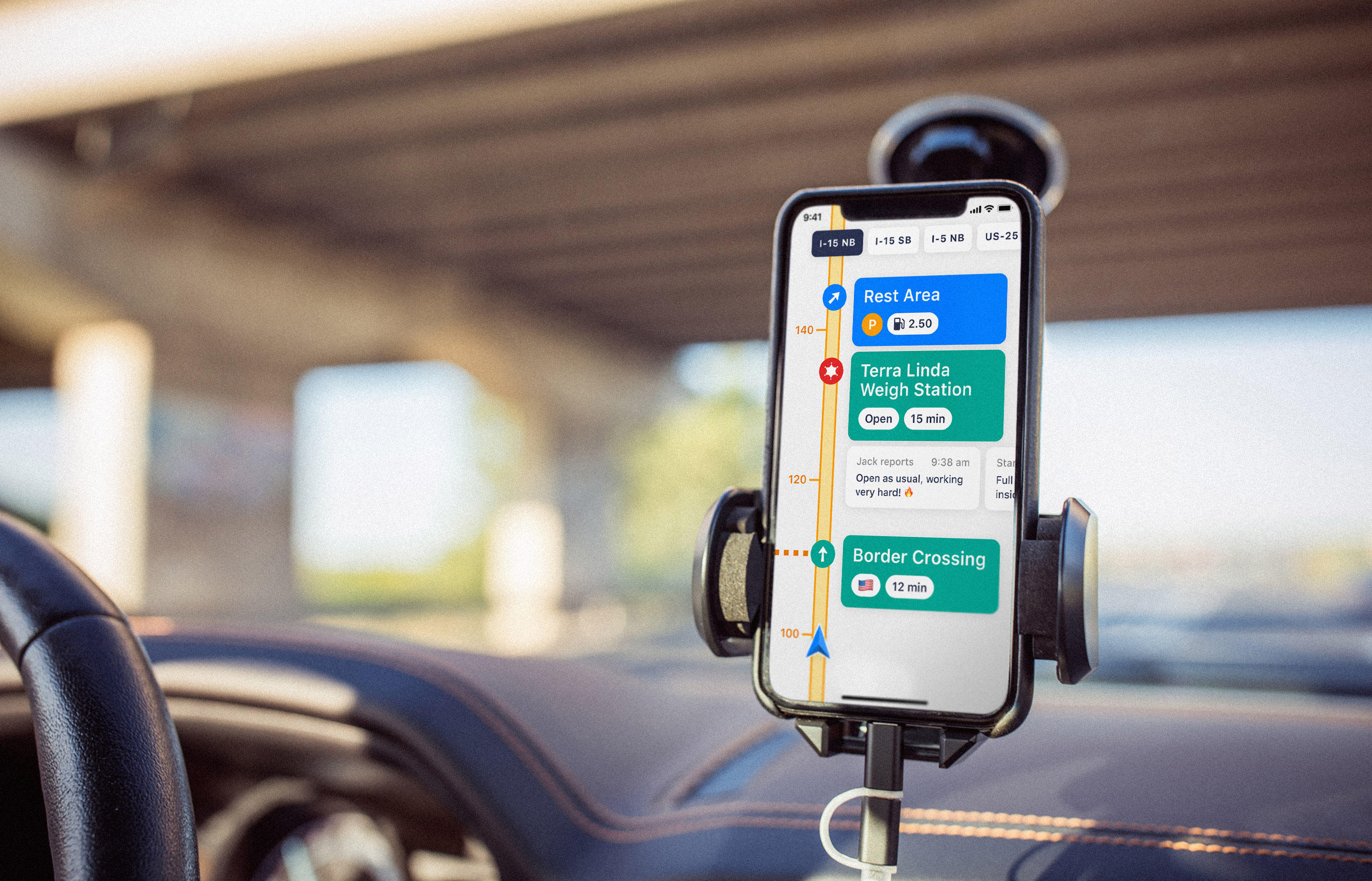
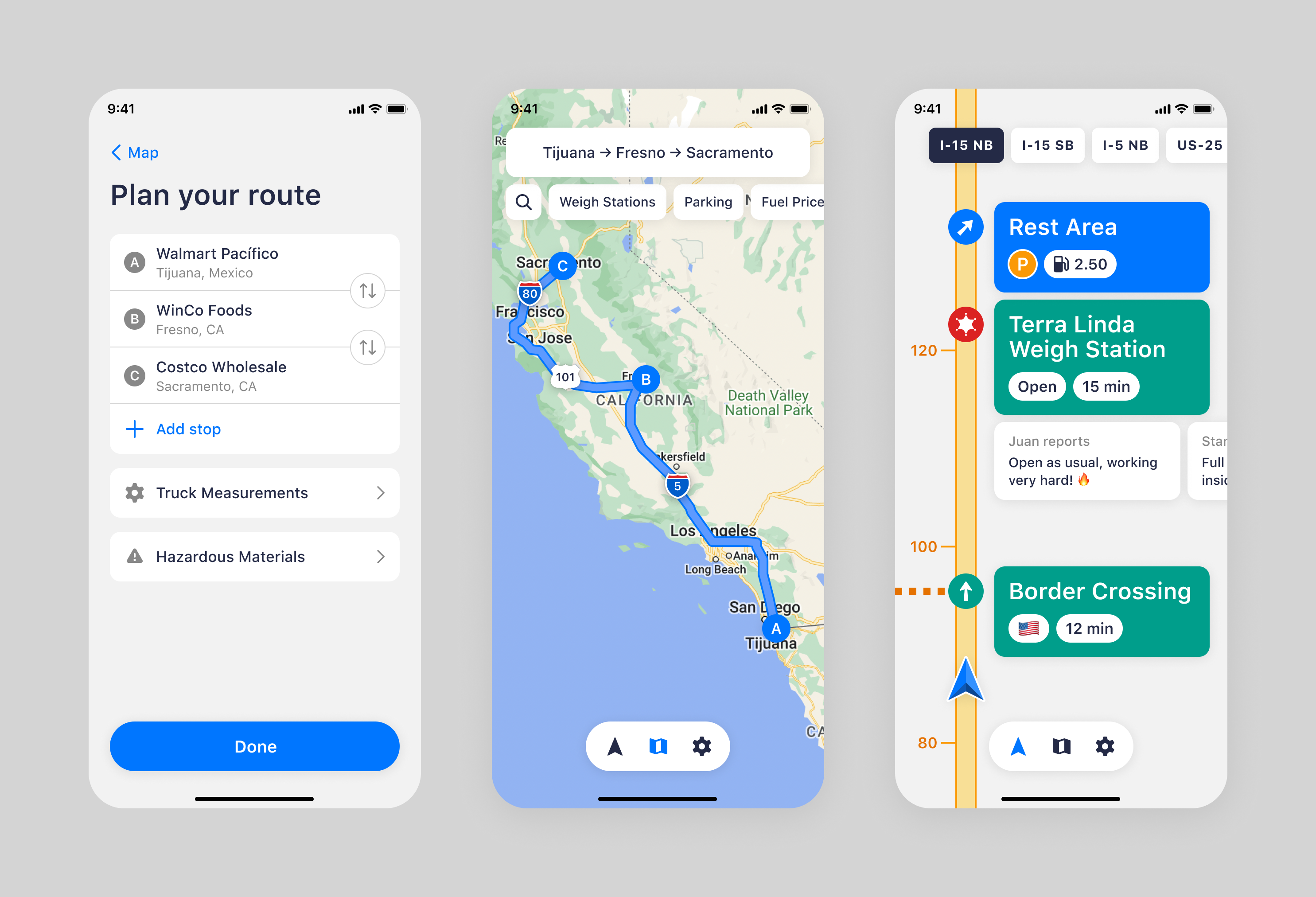
Highway is a new app mode that represents any route as a straight line.
Solution
We’re introducing the Highway mode, a new way to help truckers focus on what matters most:
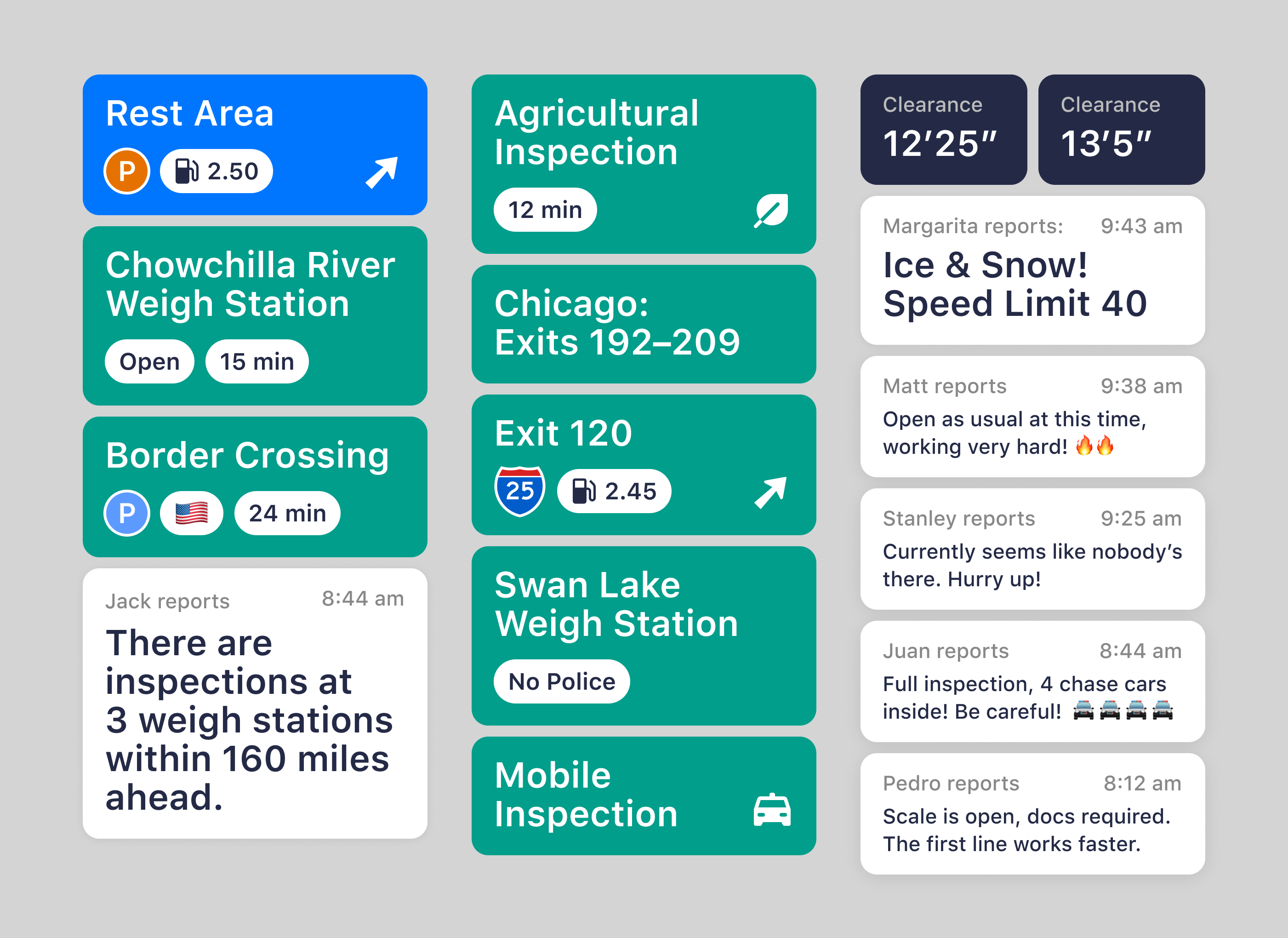
- 🚚 The shortest route to the destination
- 🚔 Police inspections ahead
- 📦 Weigh station schedules and cargo requirements
- ⛔️ State borders with estimated waiting times
- 🚧 Road accidents, dangerous zones, and bridge clearances
- ➡️ Highway exits and rest areas available on the right
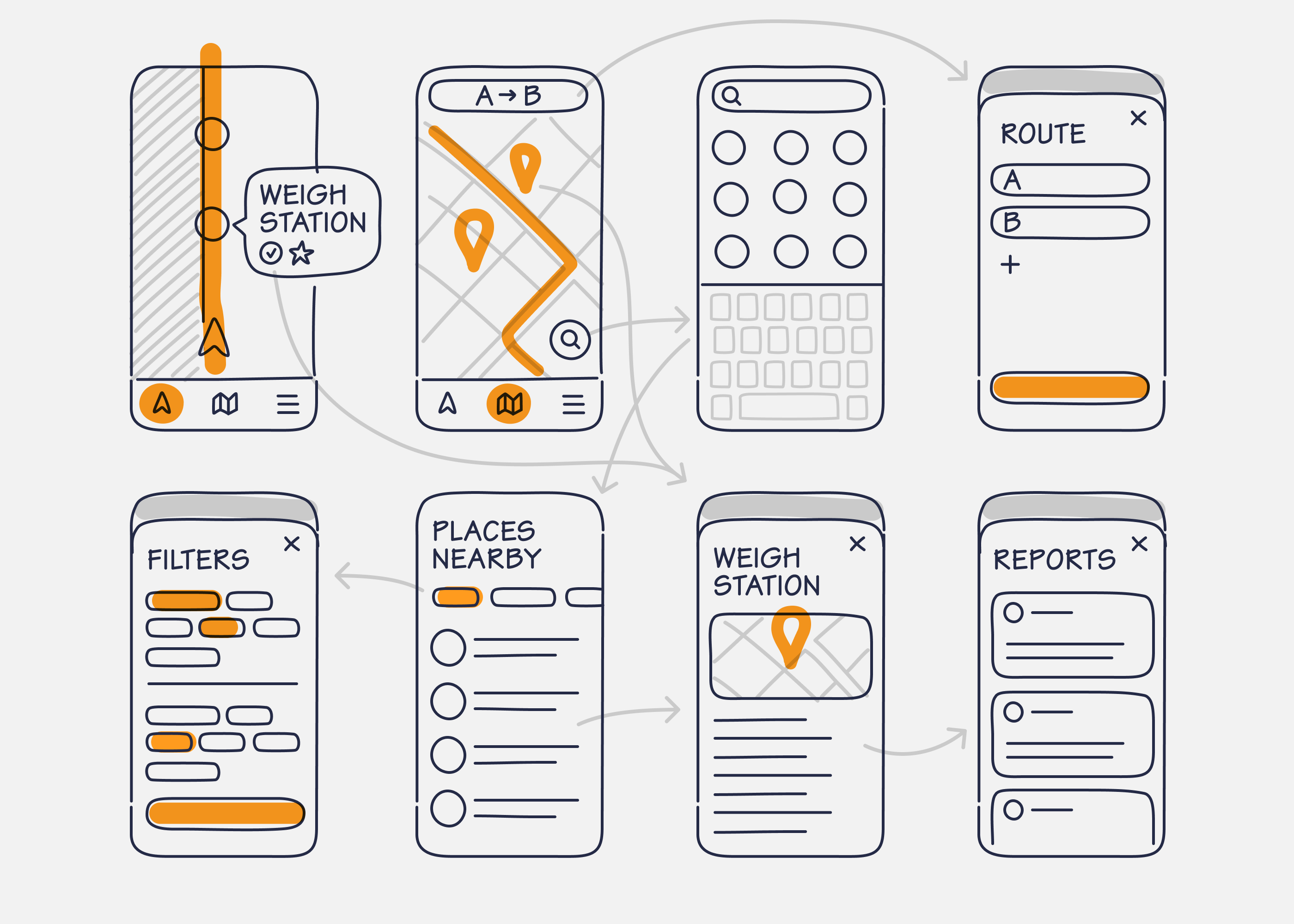
Jack Reports wireframes and navigation between screens.
The app offers two modes:
- Highway mode, a newly introduced, simplified, and focused view of essential points along the route.
- Conventional map view, a detailed look at the entire route and nearby places.
Drivers can also check details, status updates, and reports from other community members and officials.
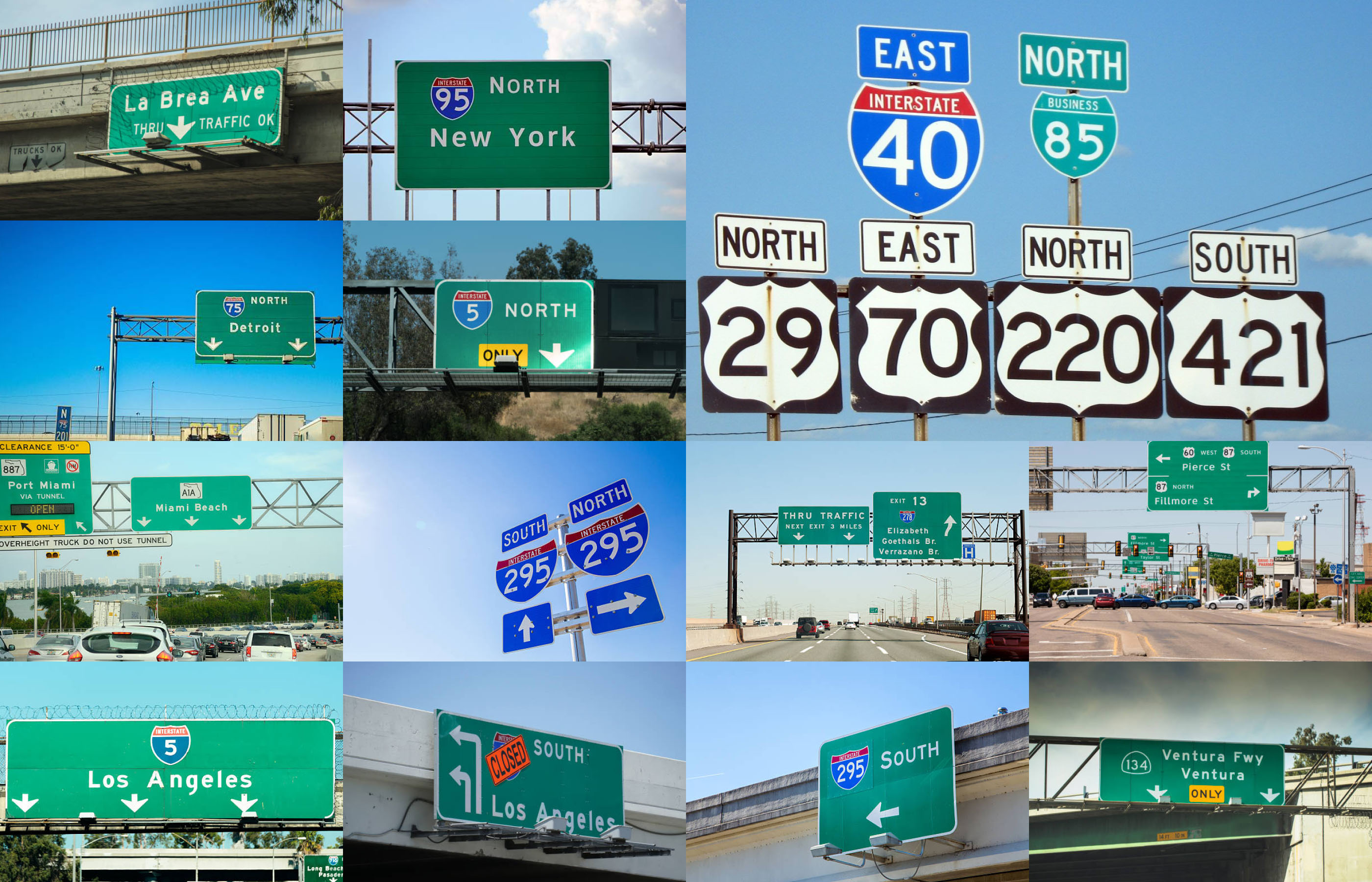
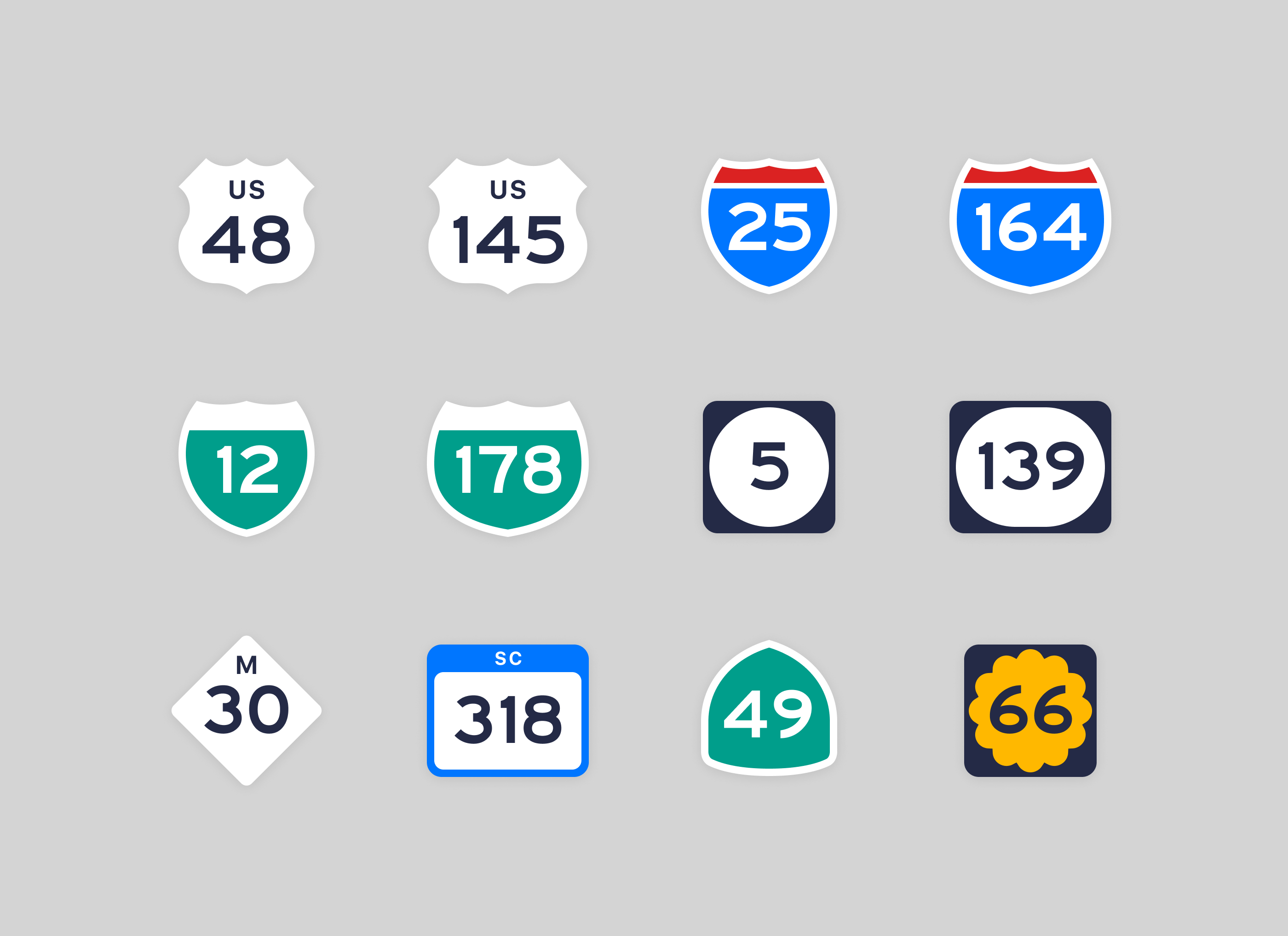
US road sign collection featuring Highway Gothic typeface.
The app’s UI design was inspired by the brutal yet fascinating layouts and iconic typography of American road signs.

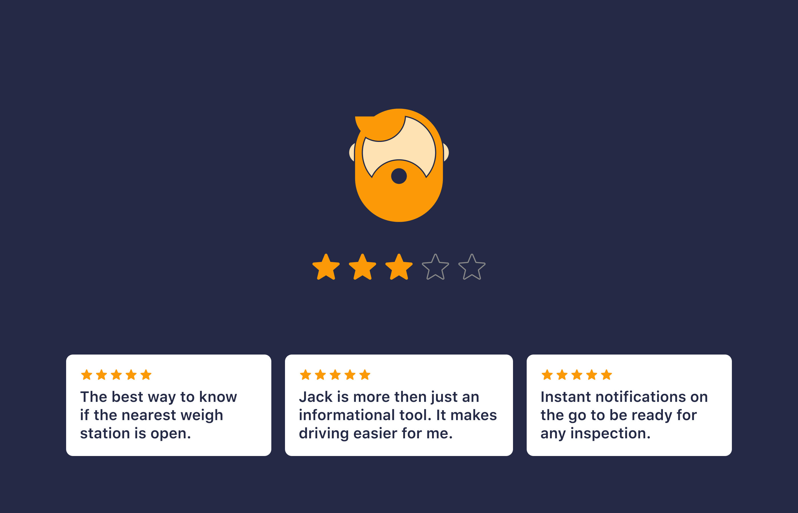
Results
The introduction of Highway mode significantly transformed how truck drivers used Jack Reports:
- Session duration increased by 75%, with drivers spending an average of 28 minutes per session.
- User retention grew by 37%, as the app became an essential tool for daily navigation.
- Community contributions doubled, with a 120% increase in real-time updates shared by drivers.
- NPS improved by 15 points, highlighting the enhanced user experience.
- Subscription rates rose by 28%, driven by the added value of the Highway mode.